- Aree Tematiche
 Carte dei Servizi
 Polizia Locale
 Ambiente
 Attività produttive
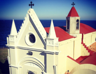 Cultura
 Documenti e certificati
 Finanza e Tributi
 Lavori pubblici
 Servizi Sociali
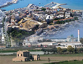 Programmi complessi
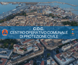 C.O.C. Centro Operativo Comunale di Protezione Civile
 Scuola ed Educazione
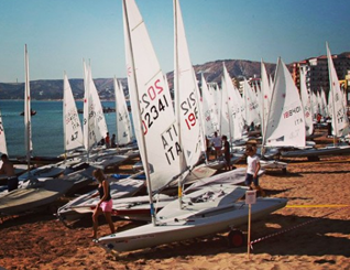 Sport e Tempo Libero
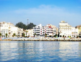 Urbanistica e Territorio
 Turismo
 Archeologia Urbana
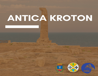 Antica-Kroton
 ATO Rifiuti
 Benemerenze Civiche
 CC.BB.RR.
 Garante Comunale dei diritti delle persone con disabilità
 Garante Comunale dei diritti dei detenuti
Sistema Difensivo

Simbolo inscindibile della città di Crotone è la storia: una storia che si scopre passo dopo passo nel suo nucleo antico, ancora racchiuso da mura e guadato da possenti fortificazioni di un severo castello. Con la sua mole imponente, i sotterranei intricati, le sue torri ed i suoi merli, questo grandioso esempio di architettura militare conserva intatto il suo fascino e il suo mistero.
A fare da cornice a tutto ciò intervengono, a ridosso della cinta muraria, il castello e le torri in cima alle quali si possono osservare a pieno splendore le coste e i litorali del territorio.
► Cinta muraria
Dopo l'acquisizione della città al regio Demanio (1541), valutando l'importanza strategica del sito, il Viceré Don Pedro De Toledo, ordinò la sua fortificazione, sia con la ricostruzione del castello, sia con la ricostruzione delle mura medioevali ormai inadatte a resistere alle nuove armi da guerra. L'opera si protrasse circa un secolo ed essendo la città priva di cave di pietra, furono usati gli ancora grandiosi resti della città greca, delle vecchie mura, macerie di case abbattute. La nuova cinta muraria, in forma poligonale, era costituita da cinque baluardi pentagonali a scarpa preesistenti e ritoccati, e da due rivellini modellati ad orecchione, siti a proteggere i fianchi del castello staccato e difeso da un fossato verso la città. I baluardi, in onore del Viceré, presero rispettivamente il nome di Don Pedro, Toledo, Marchese, Villafranca e l'ultimo conservò il nome di Pedro Nigro, che venne poi mutato in Orsini dal nome della famiglia nobile che nei pressi aveva la sua residenza.
Il Bastione Don Pedro fu detto anche delle Armi perché reca l'insegna di Carlo V e del Viceré. I rivellini sono noti, uno come Bastione del Fosso su cui è incisa la data 1550; l'altro più tardo, come la Conigliera che reca la scritta Miranda, dal nome del Viceré, sotto il quale fu costruito (1595) per consiglio dell'architetto Ambrogio Attendolo.
La struttura di cui rimangono resti evidenti è stata in gran parte realizzata nel 16° secolo riutilizzando anche più antiche fortificazioni.
Le porte erano tre: quella di terra la principale si apriva verso la campagna, ed era posta tra il Baluardo Toledo e quella Villafranca; quella segreta della Pescheria era sita presso il Bastione Pedro Nigro; e quella di mare presso la Conigliera.
L'invenzione dei proiettili esplosivi e dei cannoni a lunga gittata resero inutili le fortificazioni per cui, nel periodo francese, parte delle mura furono abbassate per garantire la ventilazione dei quartieri bassi.
Nel 1867 l'Amministrazione Comunale pervenne alla risoluzione di abbattere la porta di terra e parte delle mura per formare i portici e uno stradone panoramico verso il mare (l'attuale viale Regina Margherita). Le restanti parti, pur se rimaneggiate, sono ancora visibili ed emergenti.
Inseparable symbol of the city of Crotone is the story: a story that you find out step by step in its old core, still surrounded by walls and waded by mighty fortifications of a Castle. With its imposing size, the intricate underground, its towers and its battlements, this great example of military architecture still retains its charm and its mystery.
Framed by intervening to everything, close to the city walls, the castle and towers on top of which can be seen in full splendor coasts and shorelines of the territory.
► Walls
After the capture of the city to the Royal State Property (1541), evaluating the strategic importance of the site, the Viceroy Don Pedro de Toledo, ordered its fortification, and with the reconstruction of the castle, and with the reconstruction of the now unsuitable medieval walls to resist the new weapons of war. The work lasted about a century and being the city with no stone quarries were still used the remnants of the Greek city, the old walls of demolished houses rubble. The new walls, polygonal shape, consisted of five bastions pentagonal and two ravelins to protect the flanks of the detached castle protected by a moat to the city. The ramparts, in honor of the viceroy, took respectively the name of Don Pedro, Toledo, Marquis, Villafranca and last cherish the name of Pedro Nigro, which was later changed to Orsini from the name of the noble family that close had a residence.
The bastion Don Pedro was also called Coat of Arms and bears the insignia of Charles V and the Viceroy. The ravelins are known, one as Bastion Moat on which is engraved with the date 1550; the other one more late, with the inscription Miranda, named after the Viceroy, under which it was built (1595) on the advice of the architect Ambrogio Attendolo.The structure of which remain evident remains in large part was made in the 16th centuryalso reusing the oldest fortifications.
The doors were three: to ground the main opened to the campaign, and was located between the bastion and the Toledo Villafranca; the secret of the fish market was located at the Pedro Nigro Bastion; and that of the sea at the " Consigliera " .
The invention of projectiles and explosives of long thrown guns rendered the fortifications useless for which, in the French period, part of the walls were lowered to ensure the ventilation of the lower districts.
In 1867 the City Council came to the resolution to break down the door and the ground part of the walls to form the arcades and a scenic highway towards the sea (the current Viale Regina Margherita). The remaining parts, although reworked, are still visible and emerging.

► Castello di Carlo V
La bellezza della città è resa tale anche grazie al noto castello, costruito nell'800 d.C. per difendere la città dalle incursioni saracene e ristrutturato durante il regno di Carlo V. La fortezza di Crotone rappresenta un esempio unico tra quelle medievali e rinascimentali, poiché mostra con evidenza le trasformazioni intercorse nell'architettura militare con il passaggio dalla difesa piombante (torri circolari che guardano verso l'entroterra) alla difesa radente (bastioni prospicienti il mare). All'interno del castello, ospitati in edifici un tempo adibiti a caserma, si trovano la Biblioteca Comunale ed il Museo Civico.
Possente fortilizio bastionato a pianta poligonale costituisce una delle più importanti e massicce costruzioni militari dell'Italia Meridionale.
Esso rappresenta una tipologia unica essendo l'unico esempio di castello arroccato non già in cima ad un'altura, ma intorno al colle, che esso ingloba e racchiude nella sua interezza sul modello dell'acropoli greca, a cui consegue nel medesimo sito (Colle Cavaliere). Su preesistenti fortificazioni risalenti al periodo svevo-angioino, il castello ha subito modifiche in epoca aragonese (ristrutturazione delle torri) ed è stato ampliato e ristrutturato durante il periodo viceregnale (costruzione dei bastioni), sotto il dominio di Carlo V.
Nel 1541, sotto l'impero di Carlo V, la città di Crotone fu acquisita al Demanio Regio e il Viceré spagnolo Don Pedro da Toledo fece ricostruire il Castello nelle attuali forme, sul sostrato dell'antica fortezza pentagonale con cinque torri circolari, dando incarico agli architetti militari Giangiacomo D'Acaja e Giovanni Maria Buzzacarino.
Parte dell'antico castello fu rinchiuso nel nuovo, a pianta quadrangolare, e soprattutto ne fu modificato l'aspetto mediante l'inserimento delle preesistenti torrette angolari in due bastioni pentagonali ritoccati e speronati (San Giacomo e Santa Caterina), uniti a due torrioni cilindrici da megalitiche muraglie a cortina cordonata.
Sempre di rilevante importanza nella storia della città, con il perfezionamento delle armi da guerra, il castello perse la sua importanza strategico-militare e nel corso del sec. XIX venne parzialmente smantellato nella parte superiore, anche a seguito di danni subiti per i frequenti terremoti. Vennero così demoliti i quartieri dei soldati siti sulla cortina di sud-est, con la chiesa di San Dionigi, e la torre Marchesana, sempre emergente nel panorama cittadino dell'epoca.
Della rocca fortificata che costituiva l'antica acropoli crotoniate, non si ha notizia fino all'840 d.C., quando in occasione di una scorreria delle orde musulmane che avevano conquistato Taranto e occupato Santa Severina, queste, cintala d'assedio, tentarono più volte ed invano di espugnarla. In questo periodo non era ancora avvenuta la corruzione del nome da Crotone a Cotrone per metatesi della "erre". Quasi un secolo dopo, nel 931, i Saraceni faticosamente conquistano la città e ricostruiscono le sue mura mantenendo una flotta nel suo porto. Infatti il porto di Crotone era un comodo rifugio e la posizione della città politicamente e strategicamente importante perché costituiva una porta di accesso alle terre italiane per le armate orientali.
Nel secolo XI, i Normanni riescono a conquistare la città e nel 1140 il castello di Crotone risulta essere tra i 75 castelli allora esistenti nel Registro delle terre dei vassalli di Ruggero II.
Federico II di Svevia, fortifica il sistema dei reali castelli e cura il castello e il porto di Crotone sempre in virtù della particolare posizione strategia della città. Gli Angioini succedutisi agli Svevi, provvedono alla difesa militare della Calabria, mediante i reali castelli, che erano affidati ai castellani. Carlo d'Angiò ordina a vari feudatari tra 1270 e il 1271 a riparare le torri del castello che chiama: Mamunela, Barbacana, Triangula, Thesauro, Turricella e Turris "Ante Hostium".
► Castle of Charles V
The beauty of the city is also provided thanks to the famous castle, built in 800 AD to defend Cirra from Saracen raids and renovated during the reign of Charles V. The fortress of Crotone is an example of medieval and Renaissance, because clearly shows the transformations that occurred in military architecture with the passage of the defense pouncing (circular towers that overlook the entrance) to the sliding defense (ramparts overlooking the sea). At the interior of the castle, hosted in buildings once used as barracks, there are the municipal library and the Civic Museum.
Mighty polygonal bastion fortress constitutes one of the most important and massive military constructions of Southern Italy.
It represents a unique type being the only example of a castle not already perched on top of a hill, but around the hill, which it incorporates and encloses in its entirety on the Greek acropolis model, which is obtained in the same site (Colle Cavagliere) . On existing fortifications dating back to the Swabian-Angevin period, the castle has undergone changes in the Aragonese period (restructuring of the towers) and has been expanded and renovated during the viceroy period (construction of the ramparts), under the rule of Charles V.
In 1541, under the reign of Charles V, the city of Crotone was included to the Royal State and Spenish Viceroy Don Pedro da Toledo rebuilt the castle in its present form, on the ancient pentagonal fortress with five round towers, giving charge to military architects Giangiacomo D'Acaja and Giovanni Maria Buzzacarino.
Part of the old castle was locked in the new, quadrangular and especially it was changed the appearance by means of the insertion of the pre-existing angular turrets in two ramparts pentagonal retouched and rammed (San Giacomo and Santa Caterina), combined with two cylindrical towers by megalithic walls. Also of considerable importance in the history of the city, with the completion of military weapons, the castle lost its strategic military importance and during the XIX was partially dismantled in the upper century, as a result of damages suffered frequent earthquakes. They were so demolished neighborhoods of sites soldiers on the curtain of the Southeast, with the church of St. Dionigi, and Marchesana Tower, also in the emerging era of citizen views.
Of the fortress that was the old Croton acropolis, there is no news until 840 AD, when during a raid of Muslim hordes who had conquered Taranto and occupied Santa Severina, these, having walls of siege, tried several times and in vain to capture it. In this period he had not yet occurred corruption of the name from Crotone to Cotrone by metathesis of "r". Almost a century later, in 931, the Saracens conquered the town and rebuilt its walls maintaining a fleet in its harbor. In fact, the port of Crotone was a comfortable refuge and the city position politically and strategically important because it was a gateway to the Italian lands for the Eastern armies.
In the eleventh century, the Normans manage to conquer the city and in 1440 the castle appears to be among the 75 then-existing castles in the register of lands of vassals of Roger II. Frederick II of Sevia, strengthens the system of royal castles by caring the castle and the port of Crotone always by virtue of the strategic location of the city. The Angevins succeeded to the Swabians, provide for the military defense of Calabria, using the royal palaces, which were entrusted to the castles. Carlo d'Angio orders to various feudal lords between 1270 and 1271 to repair the castle towers called: Mamunela, Barbican, Triangula, Thesaro, Turricella and Turris "Ante hostium".
Nel 1284, sempre Carlo d'Angiò diede la castellania di Crotone a Pietro Ruffo, e nel 1296, durante la guerra dei Vespri tra Angioini ed Aragonesi, l'Ammiraglio Ruggero di Lauria invano cercò di conquistare la città. I Ruffo, signori di Crotone con il titolo di Marchese da cui deriva il nome di Marchesato che ancora si conserva, detennero la città fino al 1444, quando assieme a Catanzaro passò da Nicolò Ruffo a sua figlia Enrichetta che aveva sposato contro il volere del re, Antonio Centelles di Ventimiglia, che per aver guidato la rivolta dei baroni, morì in carcere e le sue terre confiscate. La leggenda dice che Enrichetta, marchesana di Crotone, morisse per il dolore in una sua terra detta poi, per questo motivo Crepacuore. Alfonso d'Aragona che aveva riconquistato a stento la città, resosi conto dell'importanza strategica del sito, sia come punto di offesa che di difesa, diede particolare concessioni ai cittadini, per favorire le loro attività mercantili e resa la città demaniale.
Nel 1456, concesse che la città potesse impiegare le imposte arretrate per la riparazione delle mura del castello. Nel 1497, quando entra in città il gran capitano Consalvo da Cordova, a sostegno degli spagnoli contro i francesi, le fortificazioni erano in uno stato deplorevole. Alla fine del '400 due delle torri antiche vengono inglobate in torrioni cilindrici, iniziano così i lavori di riparazioni delle regie fabbriche delle mura e del castello, che continuano per oltre un secolo e a cui è destinata la gabella della seta, che colpisce molto Cosenza e i suoi casali. In periodo viceregnale, le fortificazioni subiscono cambiamenti radicali per adeguarle alle nuove teorie sull'arte fortificatoria, che veniva formandosi per far fronte alla diffusione delle nuove armi da fuoco e in specie dell'artiglieria, anche nel regno di Napoli per la conoscenza delle opere di Francesco di Giorgio Martini. Ingegneri militari come Antonello da Trani, Juan Sarmientos, il padovano Giovanni Maria Buzzacarino, il barone leccese Gian Giacomo D'Acaja, Ambrogio Attendolo, si susseguono nella direzione delle imponenti opere di fortificazioni. Il castello da un impianto pentagonale con cinque torri ai vertici di derivazione fridericiana, viene ridotto in forma quadrata prevedendo l'inserimento delle torri circolari in quattro bastioni a scarpa ritoccati. Parte dell'antico castello fu rinchiuso nel nuovo a pianta quadrangolare e soprattutto ne fu modificato l'aspetto mediante l'inserimento di tre torrioni angolari in bastioni pentagonali ritoccati e speronati, uniti ai due torrioni cilindrici da megalitiche muraglie a cortina cordonate. La scarsezza dei materiali edilizi impose il riuso dei grandiosi resti della città greca, delle vecchie mura e delle macerie di case abbattute. Il progetto viene realizzato parzialmente con la realizzazione dei bastioni San Giacomo e Santa Caterina.
Nel 1743, il castello fu ancora vinto da Carlo IV di Borbone, che conquistò il Regno di Napoli agli Imperiali austriaci.
Nel 1799, la città, capeggiata dai suoi nobili si dimostrò favorevole alla proclamazione della repubblica partenopea, ma riconquistata in breve dal Cardinale Ruffo, furono fucilati sul castello i civici magistrati: Francesco Antonio Lucifero, Giuseppe Suriano, Bartolo Villaroja. Con il perfezionamento delle armi da guerra, il castello perde la sua importanza strategico-militare e nel corso del secolo XIX venne parzialmente smantellato nella parte superiore, anche a seguito di danni subiti per i frequenti terremoti.
Infatti il terremoto del 1832 provocò il crollo della chiesa di San Dionigi che era nel castello edella scala che conduceva alla Torre Marchesana; nel 1873 rovinò la cortina diponente e la Torre marchesana rimase gravemente lesionata, tanto che si decisela sua demolizione e quella delle murature che formavano la parte superiore della cortina sud e gli alloggiamenti; nel 1895 furono eseguite alcune demolizioni sulla spianata superiore del bastione Santa Maria.
Perduta la sua funzione strategica, il castello passò dall'Amministrazione militare al Demanio dello Stato, eccetto alcuni locali usati come caserma di fanteria.
Durante la prima guerra mondiale vi furono istallate alcune batterie costiere. Nel 1960 il Genio Civile ha ricostruito la cortina sud, e nel 1980 la Soprintendenza per i beni A.A.A. e S. ha curato il restauro della Torre Aiutante.
► Torre Tonda
Con deviazione all'ingresso nord della città, è una torre tonda di discrete dimensioni (diametro 6 metri) e di modestissimo spessore (60 centimetri), in posizione non dominante, forse più edificio rurale o vecchio roccolo.
Proprio in quel punto però indica torre Tonda, dalla carta del Rizzi Zannoni, ma non dimentica di indicare la valle di Lampos.
Piccola costruzione a pianta circolare, di datazione incerta ma di tipologia normanna.
Già alla fine dell'Ottocento risultava mozza ed adattata a costruzione rurale.
La collina nei pressi di Crotone, sulla quale è sita, era forse sede in epoca greca del tempio dedicato alla Vittoria.
► Torre Nao
Più semplicemente conosciuta come Torre di Nao o Torre Nao, è un monumento a pianta quadrangolare risalente al XVI secolo situato alla punta nord di Capo Colonna, in provincia di Crotone. Il faro sorge su una prominenza, che chiude la prima insenatura verso sud contrapposta a Punta Cicala. Torre di tipologia viceregnale, ha corpo parallelepipedo su base troncopiramidale, con cordolo litico e grosse caditoie. La costruzione della torre di Nao, che presenta pianta quadrangolare, con esterno scandito da cordonatura litica, fu portata a termine nel 1568, sotto Parafan de Ribera,sebbene il Pignatelli, fin dal 1565, ne aveva assicurato l'avvenuto completamento. Venuto meno il pericolo delle incursioni saracene, le torri di guardia costiera persero ogni funzione di difesa e, nel 1810, la torre di Nao fu inclusa nel sistema doganale francese. In seguito all'Unità d'Italia questa torre divenne sede di comando di una brigata della Guardia di Finanza, mentre quella di Scifo fu venduta a privati e quella di Mariello, lasciata in stato di abbandono, fu usata come cava di pietra.
In 1284 Charles of Anjou gave the castle district of Crotone to Pietro Ruffo, and in 1296, during the War of the Vespers between Angevin and Aragonese, the admiral Roger of Lauria vainly try to conquer the asphalt. The Ruffo, Lords of Crotone with the title of Marquis hence the name of the Marquis which still remains, detained the city until 1444, when together with Catanzaro passed from Nicolo Ruffo to his daughter Henrietta who had married against the wishes of the king Antonio Centelles of Ventimiglia, which for leading the revolt of the barons, died in prison and his lands confiscated. Legend says Henrietta, Marchioness of Crotone, died for the pain in his homeland later called, for this reason Creapacuore. Alfonso of Aragon, who had barely regained the city, realizing the strategic importance of the site, both as a point of offense and defense, gave special concessions to the people, to promote their activities and made the state-owned merchant city.
In 1456, he granted that the city could use the back taxes for redecorating the castle walls. In 1497, when it enters the city Great Captain Consalvo of Cordova, in support of the Spaniards against the French, the fortifications were in a deplorable state. At the end of 400 two ancient towers are incorporated in the cylindrical towers, begin so the works of repair of the royal of the castle walls factories that continue for more than a century and it is intended for the excise of silk, which strikes Cosenza and its hamlets . In the period of the viceroy, the fortifications undergo radical changes to adapt them to new theories about fortifying art, which was being formed to deal with the spread of new firearms and especially of artillery, even in the kingdom of Naples to the knowledge of the works of Francesco di Giorgio Martini. Military Engineers as Antonello da Trani, Juan Sarmientos, Giovanni Maria Buzzacarino, Gian Giacomo D'Acaja, Ambrogio Attendolo, follow one another in the direction of imposing works of fortification. The castle from a pentagonal plant with five towers at the tops of Frideric derivation is reduced in square form by inserting the circular towers in four rebuilt shoe bastions. Part of the castle was enclosed in the new quadrangular plant and its appearance was modified by the insertion of three angular towers in pentagonal and spurred ramparts, joined by the two cylindrical towers of megalithic curved curtain walls. The scarcity of building materials imposed the reuse of the great remains of the Greek city, the old walls and the ruins of demolished houses. The project is partially realized with the construction of the bastions San Giacomo and Santa Caterina.
In 1743, the castle was still won by Charles IV of Bourbon, which conquered the Kingdom of Naples from the Austrian imperial.
In 1799, the city, headed by its nobles, proved to be in favor of the proclamation of the Parthenopean replubbism, but soon regained by Cardinal Ruffo, the magistrates' houses were shot at the castle: Francesco Antonio Lucifero, Giuseppe Suriano, Bartolo Villaroja. With the refinement of warfare, the castle loses its strategic-military significance and in the course of the XIX century it was partially dismantled at the top, also as a result of damage suffered by frequent earthquakes.
In fact, the earthquake of 1832 provoked the collapse of the church of San Dionigi, which was in the castle and the staircase leading to the Marechesana Tower; In 1873 the west curtain and the Marchesan Tower remained severely damaged, so much so that it was demolished and that of the masonry that formed the upper part of the south curtain and the enclosures; In 1895 some demolitions were carried out on the upper plain of the Santa Maria bastion.
Losing its strategic function, the castle from the Military Administration to the State Democracy, except some premises used as infantry barracks.
During the First World War some coastal batteries were installed. In 1960 Genio Civile reconstructed the south curtain, and in 1980 the Superintendency for goods and Scared for the restoration of the Assistant Tower.
► Tower Tonda
With deviation at the north entrance of the city, it is a discrete (diameter 6 meters) and very modest 60 cm (60 centimeter) tower, in a non-dominant position, perhaps more rural or old rocks.
Just at that point indicates Tonda tower, given by the Rizzi Zannoni map, but do not forget to indicate the valley of Lampos.
Small circular, uncertain dating but of Norman type. At the end of the nineteenth century it was stale and suitable for rural construction.
The hill near Crotone, on which it is located, was probably the home of the Greek temple dedicated to Victory.
► Tower Nao
More simply known as Torre di Nao or Torre Nao, it is a quadrangular plant dating to the 16th century located at the north tip of Capo Colonna, in the province of Crotone. The lighthouse rises on a prominence, which closes the first south-facing creek opposite Punta Cicala. Tower of Viceroy typology, has a parallelepiped body on a truncopiramidal base, with cytology and large cascades. The construction of the tower of Nao, which has a quadrangular plant with an exterior marked by a lithing line, was completed in 1568 under Parafan de Ribera, although the Pignatelli had assured that it had been completed since 1565. The danger of Saracen raids diminished, the Coast Guard towers lost all defense functions, and in 1810 Nao's tower was included in the French customs system. Following the unity of Italy, this tower became the headquarters of a Guard of Finance, while Scifo was sold to private and that of Mariello, left in abandonment, was used as a quarry of stone.

Dell'aspetto della torre di Nao nel secolo XVIII è testimonianza una stampa francese del tempo, disegnata dal Desprez.
È evidente il sistema di difesa della torre: la scala a tre rampe formava un "vignale", corpo avanzato di difesa, tra la scala e la torre un ponte levatoio a scomparsa, azionato dall'interno da una carrucola, garantiva l'isolamento della torre.
All'ingresso, sul 3° livello, un solaio mobile ed una caditoia ne garantivano l'estrema difesa. Anche qui ritroviamo un sistema misto di difesa, tipico dell'architettura militare di transizione. Alla difesa radente si affianca la difesa piombante caratterizzata la prima dalla presenza di archibugere trasformate successivamente in finestra, la seconda da piombatoi in aggetto sull'ultimo livello.
Al confronto della stampa citata, l'aspetto attuale della torre, restaurata di recente, appare modificata.
► Torre Scifo
Il paesaggio continua ad essere ben protetto, anche se in zona agricola Scifo sta irreparabilmente decadendo: uno splendido edificio che è urgentissimo recuperare.
Torre di tipologia viceregnale, a pianta quadrangolare, con parte inferiore a scarpa e scala esterna, fu detta anche delle Civette.
Dismessa dallo stato sabaudo, fu acquistata nel 1870 dalla nobile famiglia Lucifero, che ancora la detiene.
► Torre Marianello
La torre di Capo Colonna, detta anche torre Mariello, è una struttura difensiva edificata lungo il litorale crotonese nel corso del XVI secolo. A pianta quadrata, era munita di robusti contrafforti e cordonatura in pietra.
Il fortilizio, dotato di una scala esterna e di un piccolo ponte d'accesso, fu voluto dal viceré spagnolo Pedro di Toledo e rientrava nel dispositivo di difesa costiera, di cui facevano parte anche la torre di Scifo o dei Saraceni, di forma quadrangolare, e la torre di Nao, edificata nel 1550, e recentemente oggetto di restauro.
Torri e Castelli del territorio
Of the appearance of the tower of Nao in the seventeenth century is evidence of a French press of the time, drawn by Desprez. Obviously the tower defense system: the three-lane staircase formed a "vignal", an advanced defensive body, between the staircase and the tower a retractable drawbridge, driven by the inside of a pivot, secured the tower's isolation.
At the entrance, on the 3rd level, a mobile slate and a cadenza guards secured the utmost defense. Again here we find a fixed defense system, typical of the military transition architecture. The defensive lead is accompanied by the lead defense characterized the first by the presence of archibuges transformed later into the window, the second by the piumbatoi in the ridge on the last level.
Compared to the print quoted above, the current appearance of the tower, recently restored, appears to be altered.
► Scifo Tower
The landscape continues to be well protected, although in Scifo's agricultural area it is irreparably declining: a splendid building that is urgently needed to recover.
Tower of Viceroy typology, with quadrangular plan, with lower part on shoe and external staircase, was also called the Cecettes.
Dismissed by the Savoy state, it was acquired in 1870 by the noble Lucifero family, that still holds it.
► Marianello Tower
The Tower of Capo Colonna, also called the Mariello Tower, is a defensive structure built along the Crotone Coast during the 16th century. At a square plant, it had robust buttresses and stone cords.
The fortress, with an exterior staircase and a small bridge of light, was designed by the Spanish Viceroy Pedro of Toledo, and was part of the coastal defense device, including the quadrilateral square tower of Scifo or Saracens. The tower of Nao, built in 1550, and recently restored.
Fonte: Settore Turismo
Data ultimo aggiornamento: 17 Agosto 2017
Revisionato da: Alessandra Vrenna
Traduzione a cura di:
